
Sinkholes in the USA: What the Ground Can Hide Before You Build
Ground risk, karst geology and the limits of point-based investigation
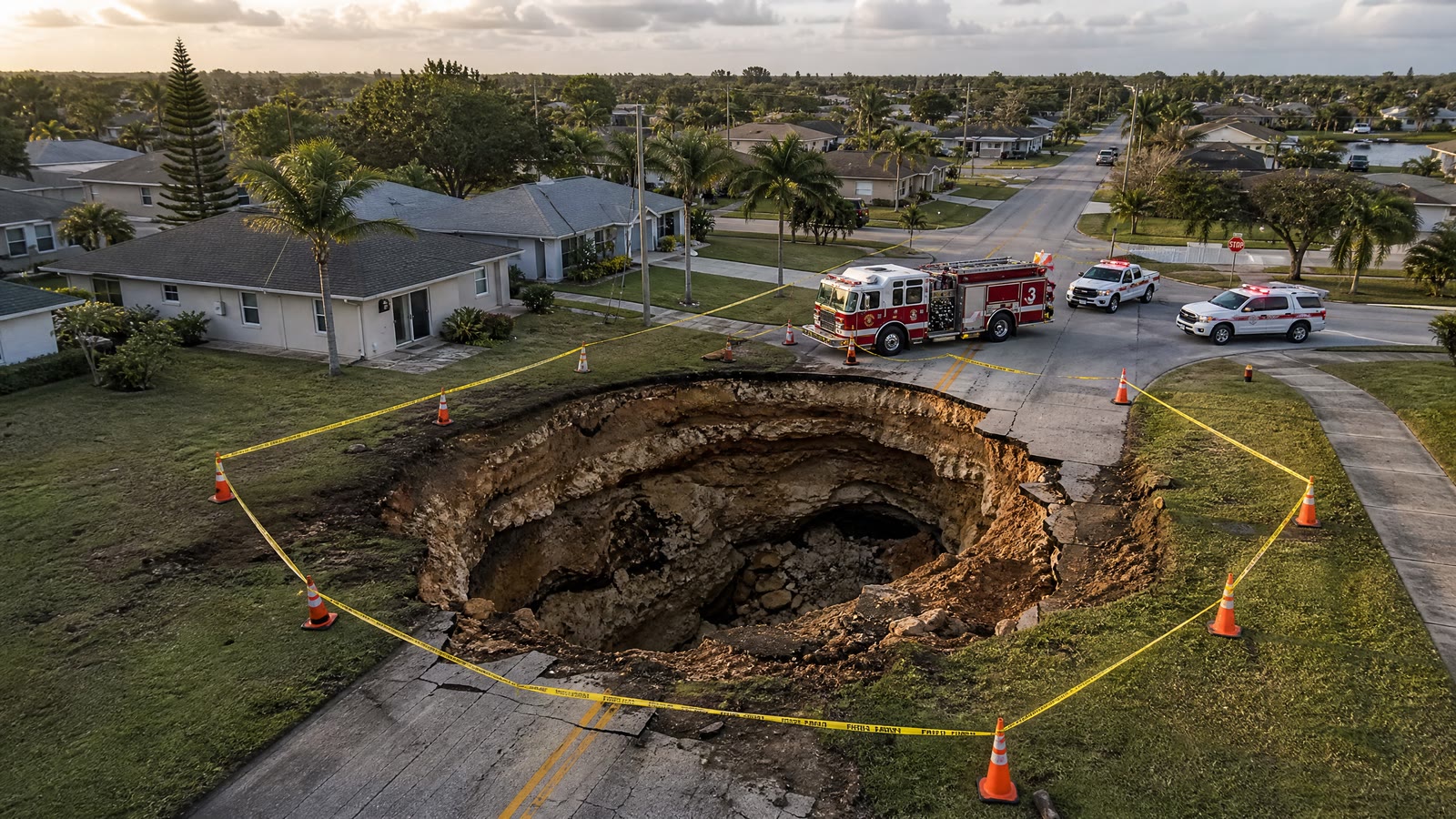
A development site can be flat, dry and apparently uneventful. Survey markers stand in the grass. Access roads are firm. Nothing at the surface suggests that, a few metres below, groundwater has been working on the rock for centuries. It enters hairline fractures, dissolves limestone, widens passages and carries fine material away. The ground remains in place until one day it does not. This is the unsettling character of sinkhole risk. Its most important features are often invisible from above, yet their consequences are entirely physical: a cracked slab, a distorted foundation, a broken utility line or, in the most dramatic cases, a road or building collapsing into a void that nobody knew was there.
Approximately 40 percent of the contiguous United States is underlain by carbonate rocks or evaporites capable of developing karst features. Limestone, dolomite and gypsum dissolve slowly in groundwater, leaving a landscape shaped not only by what can be seen - springs, depressions and caves - but by an irregular architecture beneath the surface. For developers, infrastructure operators, lenders and investors, this is not an unusual geological footnote. It is a material design and capital risk.
A risk that extends far beyond Florida
Florida provides the familiar images: circular depressions appearing in lawns, roads dropping without warning and buildings evacuated as the ground moves. Yet the American karst belt is much larger. It includes the limestone plateaus of Texas, the Ozarks of Missouri and Arkansas, the Valley and Ridge province from Alabama through Virginia and Pennsylvania, and dolomite areas across the upper Midwest. Natural dissolution is only part of the picture. More than a century of underground coal and mineral extraction has left workings beneath parts of Appalachia, the Illinois Basin, the Midwest and the Mountain West. Some mines are documented in detail. Others were worked before modern surveying, abandoned with incomplete records or altered in ways that no surviving plan describes accurately. These two processes - natural karst formation and the deterioration of human-made mine workings - produce different underground geometries. For the asset above, however, they create a similar question: is the apparently solid ground carrying loads in the way the design assumes?
How natural karst loses its balance
Karst does not form as a neat empty chamber beneath an otherwise uniform rock mass. It develops along fractures, bedding planes and pathways taken by water. Voids may be narrow and vertical, broad and irregular, open, partly filled with sediment or concealed beneath an arch of weakened material. Many such structures remain stable for long periods. Stability, however, is conditional. A falling water table can remove buoyant support. Heavy rain after drought can wash soil into openings. A leaking pipe can create a new local flow path. Construction can add surface load or change drainage. None of these events has to create a cavity from nothing. It may only have to disturb an equilibrium that had persisted unnoticed. That is why a site without visible sinkholes cannot automatically be treated as a site without sinkhole risk. The absence of surface expression may mean that no cavity exists. It may also mean that the final stage of upward collapse has not yet occurred.
Mine workings fail differently
An abandoned mine begins with a known act: material was removed and pillars or supports were left to carry the roof. What happens later may be much less certain. Supports degrade, pillars crush and roofs fall. A local collapse can migrate upward through the overburden or transfer additional load to neighbouring pillars, producing further failure. The surface effect need not sit directly above the first underground failure. Collapse geometry, depth, pillar behaviour and the angle through which subsidence propagates can enlarge or shift the affected zone. Progressive subsidence may distort a structure slowly. A more brittle failure may create a sudden depression. Age alone is not reassurance. A working that remained quiet for decades can still be affected by groundwater change, deterioration or new loading. For development purposes, old workings are not merely part of a site's history. They are part of its present load path.
Why conventional investigation can miss the decisive feature
A borehole gives a remarkably detailed account of a very small cylinder of ground. It can identify strata, recover samples and support laboratory testing. A cone penetration test can describe resistance continuously with depth at another precise point. Both are essential tools. Neither, by itself, describes everything between the test locations. This limitation matters most where geology is irregular. Imagine a narrow dissolution pipe lying two metres from a borehole. The borehole may pass through competent rock from top to bottom and report exactly what it encountered. It has not failed. The investigation pattern has simply not intersected the feature that matters. Making the grid denser improves the odds, but on a large site the number of points needed to provide genuine spatial confidence may become expensive long before design is fixed. The problem is therefore not a contest between drilling and geophysics. It is a question of sequence and coverage: how can the site first be understood as an area, so that intrusive work can then be directed at the places where it will answer the most useful questions?
From point sampling to area imaging
Non-invasive subsurface surveys approach the ground laterally as well as vertically. Instead of relying only on separated points, they look for spatial changes that may indicate voids, weakened zones, dissolution structures or old workings. The result is not a single statement that the site is safe or unsafe. It is a map of relative confidence: areas that behave consistently, zones that require closer examination and anomalies that should influence the next stage of investigation. This broader picture allows the campaign to become adaptive. When results are available in the field, a team can tighten survey spacing around an anomaly, extend a line to understand its direction or select validation points while equipment is still on site. Intrusive testing can then be concentrated where it has the highest informational value. Non-invasive work also reduces disturbance during early due diligence. It does not remove the need for geotechnical verification, nor does it replace foundation engineering. Its value lies in reducing the chance that the most important feature remains between the boreholes.
The moment geology becomes finance
Ground risk becomes expensive at the point when it arrives late. Before land acquisition or foundation design, an anomaly is information. After signing, it may become a redesign. During construction, it may become delay, additional piling, grouting or ground improvement. Once an asset is operating, it can become an interruption, an insurance dispute and a question about the value of the collateral itself. For a developer, the survey should distinguish where conventional foundations may be suitable from where further investigation or a different foundation concept is justified. For an investor, it should describe plausible remediation scenarios and their cost implications. For a lender, it should help answer a simple but consequential question: does the security rest on competent ground? The findings should therefore enter the financial model as quantified sensitivities. What additional capital could be required if an anomaly proves material? How would that affect the construction programme, contingency and debt drawdown? Could the site layout move a heavily loaded building away from the highest-risk area? These are not geological questions alone. They are decisions about value.
Investigate before certainty becomes expensive
The ground beneath a site does not adapt itself to the transaction timetable. Karst continues to respond to water. Old mine workings continue to age. A surface that appears calm may conceal a structure that has not yet announced itself. The practical objective is not to prove that an entire parcel contains no uncertainty. It is to discover where uncertainty is concentrated, determine which mechanisms may be active and decide how the design and investment case should respond. Area imaging, targeted validation and disciplined engineering interpretation turn an invisible hazard into a manageable one.
The cavity that damages a project is rarely the cavity everyone knew about. It is the one that remained unseen until the cost of seeing it had become much higher.